Climate & Weather
The most accurate weather forecast for the reserve is from the Norwegian Meteorological Institute and can be found at:
Short-term Weather Forecast – today + 2 days ahead
Long-term Weather Forecast – 9 days ahead
Check out the Ultraviolet Radiation Index forecast for South Africa at:
UV Index Forecast – one day ahead
Each season in the Witteberg Private Nature Reserve has its own unique character and beauty.
The average annual rainfall is about 380 mm. The climate is characterised by cool, wet winters and warm summers with occasional thunderstorms. July is the wettest month of the year.
Summer temperatures (November to February) are slightly higher than that experienced in Cape Town, with January the hottest month of the year. Clear blue skies are the norm.
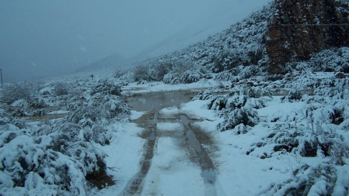
Winter temperatures (May to August) are somewhat lower than that experienced in Cape Town, with the possibility of light frost occurring. July is the coldest month of the year. The Witteberg mountain peaks are snow-capped for a couple of short spells during winter, often melting on the same day. However, the cool evenings are ideal for making cosy log fires.
As is typical in the Western Cape, winds from the north-west usually occur in winter, are gusty and signal the start of overcast weather and the possibility of rain. Similarly, winds from the south-east usually occur in summer, are more constant and bring clouds that seldom cause rain. In autumn and spring, the north-east wind brings the heat from inland.
During autumn (March and April), the summer heat subsides and the wind settles.
Veld flowers bloom throughout the year, but spring (September and October) usually brings the most spectacular display of Witteberg proteas, other fynbos and succulent flowers.
|
Annual Rainfall (millimetres) |
|
|
Year |
Total Rainfall |
|
1999 |
227 |
|
2000 |
272 |
|
2001 |
341 |
|
2002 |
419 |
|
2003 |
265 |
|
2004 |
302,5 |
|
2005 |
250,5 |
|
2006 |
384 |
|
2007 |
435 |
|
2008 |
495 |
|
2009 |
378 |
|
2010 |
275 |
|
2011 |
490 |
|
2012 |
410 |
|
2013 (ytd 2013-10-28) |
387 |
|
Monthly Rainfall (millimetres) |
|||
|
Month |
Minimum monthly rainfall |
Average monthly rainfall |
Maximum monthly rainfall |
|
January |
2 |
7,8 |
18 |
|
February |
1 |
7,7 |
13 |
|
March |
2 |
16,7 |
42,5 |
|
April |
19 |
55,5 |
59 |
|
May |
45 |
61,5 |
92,5 |
|
June |
26 |
48,3 |
74,5 |
|
July |
37 |
70,8 |
93 |
|
August |
15,5 |
46,7 |
78,5 |
|
September |
1 |
19,2 |
51 |
|
October |
15 |
25 |
43,5 |
|
November |
18,5 |
67,8 |
95 |
|
December |
0,5 |
23,2 |
63,5 |
Highest monthly rainfall recorded – 7 December 2002
|
Ultraviolet Radiation Factor |
||
|
Month |
Average ultraviolet factor |
Maximum ultraviolet factor |
|
January |
12,5 |
15,7 |
|
February |
12,2 |
15 |
|
March |
9,6 |
12,7 |
|
April |
6 |
8,5 |
|
May |
3,6 |
5 |
|
June |
2,2 |
3 |
|
July |
2,8 |
4,3 |
|
August |
4,7 |
7,3 |
|
September |
7,9 |
11,3 |
|
October |
11,2 |
14 |
|
November |
12,9 |
16 |
|
December |
13,6 |
16,5 |
|
Temperature statistics in degrees Centigrade |
||||
|
Month |
Minimum Monthly |
Average |
Average |
Maximum |
|
January |
10 |
15,7 |
34,7 |
45,3 |
|
February |
9,8 |
16 |
34,3 |
45,4 |
|
March |
6,3 |
13,3 |
31 |
42,3 |
|
April |
4,1 |
10,5 |
26,7 |
38,6 |
|
May |
1,5 |
8,2 |
20,7 |
32,5 |
|
June |
0,8 |
6,1 |
17,4 |
24,8 |
|
July |
0,1 |
5,5 |
17,7 |
26 |
|
August |
0,5 |
5,4 |
18,2 |
25,8 |
|
September |
-0,6 |
7 |
23,3 |
37,2 |
|
October |
-0,4 |
10,1 |
27,7 |
39,4 |
|
November |
5,3 |
11,8 |
29,3 |
42,8 |
|
December |
7,2 |
14,4 |
32,2 |
42,5 |
Lowest temperature recorded was -0,6oC on 10 September 2008
Highest temperature recorded was 45,4oC on 2 February 2006
Rainfall statistics have been recorded since January 1999
Other weather statistics have been recorded since January 2006
(Page last updated 2014-01-20)


